Describing wing shape variations within, between and among populations of Aedes albopictus Skuse using relative warp analysis
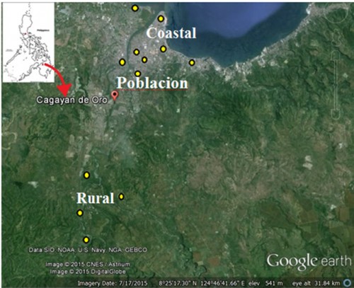
 Fig. 1:
 Google-earth Satellite image of Cagayan de Oro City and the locations (in yellow dots) of sampling sites in coastal, poblacion and rural areas of the City.
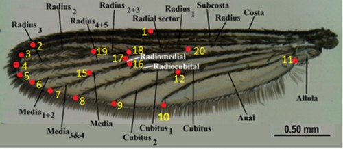
 Fig. 2:
 The 20 landmarks created from TpsDig2 software from a labelled generalized mosquito wing, image courtesy of WRBU Mosquito Identification software, WRBU.
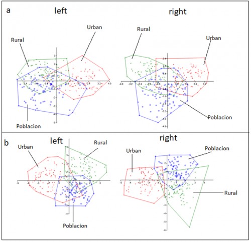
 Fig. 3:
 MANOVA CVA scatter plot of left and right wings of female (A) and male (b)
Ae. Albopictus


