- Printed Journal
- Indexed Journal
- Refereed Journal
- Peer Reviewed Journal
Subscribe Print Journal

Zoological Record Indexing

Important Information
- Helpline for Authors
- India: +91-9711224068
- Toll Free: 1800-1234070
- Working hours 10:00 AM-06:00 PM
Issue Bar
Open Access
Side Bar
Identifier

Vol. 5, Issue 5, Part A (2018)
Modelling of malaria hotspot sites using geospatial technology in the north-western highlands of Ethiopia
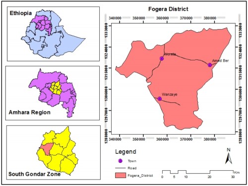
Fig. 1: Location of Fogera District
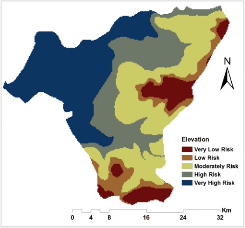
Fig. 2: Environmental factors that greatly influence malaria incidence and prevalence in the study. a) Reclassified elevation.
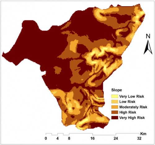
Fig. 3: Environmental factors that greatly influence malaria incidence and prevalence in the study. b) Reclassified slope.
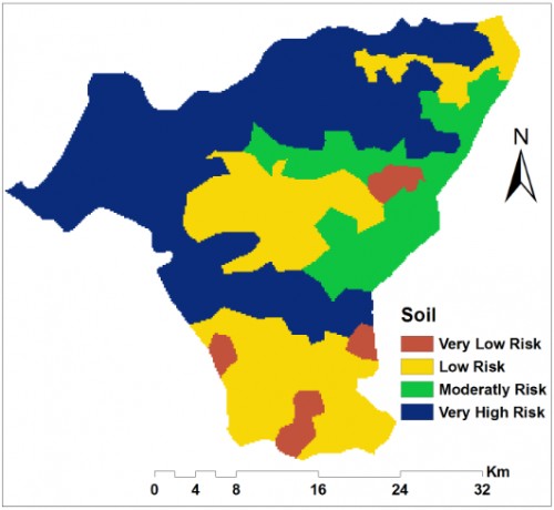
Fig. 4: Environmental factors that greatly influence malaria incidence and prevalence in the study. c) Reclassified soil.
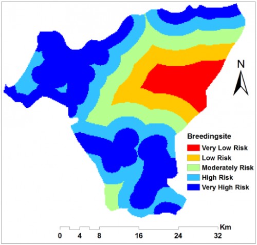
Fig. 5: Environmental factors that greatly influence malaria incidence and prevalence in the study. d) Reclassified distance from breeding sites
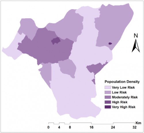
Fig. 6: Socio-economic factors that affect malaria occurrence and distribution in the study. a) Reclassified population density.

Fig. 7: Socio-economic factors that affect malaria occurrence and distribution in the study. b) Reclassified distance from health facilities.
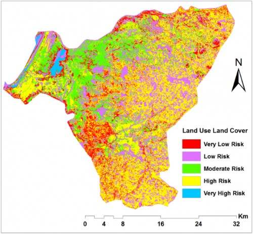
Fig. 8: Socio-economic factors that affect malaria occurrence and distribution in the study. c) Reclassified land uses
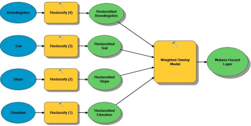
Fig. 9: Malaria Hazard Layer developed in Arc GIS software
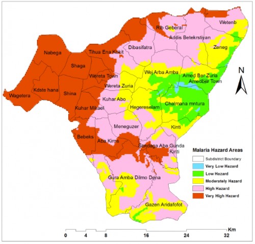
Fig. 10: Malaria hazard areas mapped using weighted overlay Model in Arc GIS
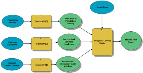
Fig. 11: Malaria Risk layer developed in Arc GIS software
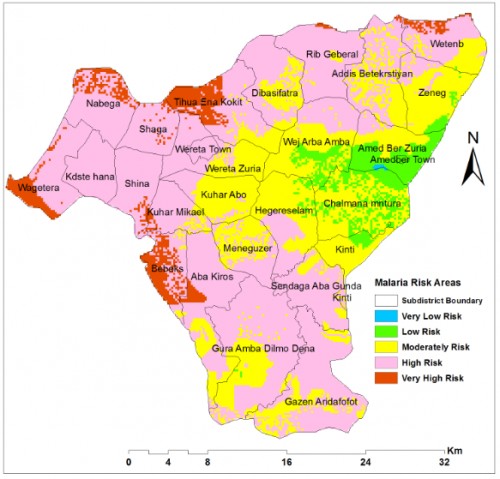
Fig. 12: Malaria Risk Areasidentified using Weighted overlay Model in Arc GIS
Zoological Record Indexing
Important Information
- Helpline for Authors
- India: +91-9711224068
- Toll Free: 1800-1234070
- Working hours 10:00 AM-06:00 PM
Issue Bar
Open Access
Side Bar
Identifier
Related Links

International Journal of Mosquito Research