Vol. 2, Issue 3, Part A (2015)
Geographical information system based study on Dengue and Chikungunya at Western Ghats districts, Tamil Nadu, India
Author(s): N. Bharathi, C.M. Ramakritinan, K. Kolandaswamy
Abstract: Methods: Dengue and Chikungunya outbreak reports were obtained from sentinel diseases surveillance centers. Entomological parameters were applied to investigate and monitor fever outbreaks. Meteorological data was obtained from India Meteorological Department for risk factors analysis. ArcGIS modeling was done to generate risk map of Dengue and Chikungunya incidences with four risk levels i.e. very high, high, medium and low in three districts.
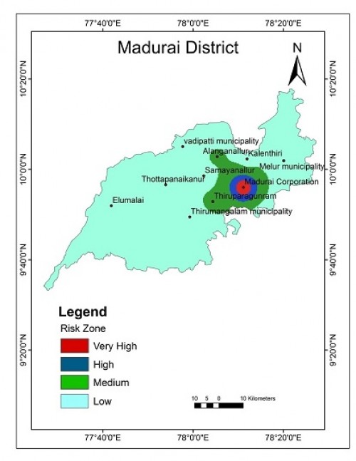 Fig.:
Fig.: Mapping of Chikungunya risk zone in Madurai district at 2011.

How to cite this article:
N. Bharathi, C.M. Ramakritinan, K. Kolandaswamy. Geographical information system based study on Dengue and Chikungunya at Western Ghats districts, Tamil Nadu, India. Int J Mosq Res 2015;2(3):30-38.