- Printed Journal
- Indexed Journal
- Refereed Journal
- Peer Reviewed Journal

Subscribe Print Journal

Zoological Record Indexing

Important Information
- Helpline for Authors
- India: +91-9711224068
- Toll Free: 1800-1234070
- Working hours 10:00 AM-06:00 PM
Issue Bar
Open Access
Side Bar
Identifier

Vol. 4, Issue 4, Part B (2017)
Mosquito larval habitat mapping using remote sensing and GIS for monitoring the filarial infection regions in Alkorin village, Sharkia Governorate (Egypt)

Fig. 1: Location of study area and sites of collection.
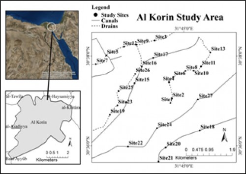
Fig. 2: Location of study area and sites of collection.
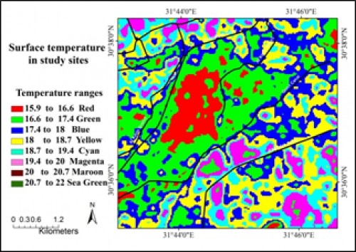
Fig. 3: Satellite image for study area show temperature ranges in autumn 2015.
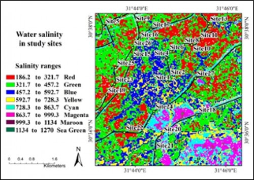
Fig. 4: Satellite image for study area show salinity ranges in autumn.
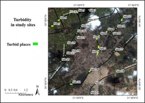
Fig. 5: Satellite image for 14 turbid sites and 13 non turbid sites in study area.
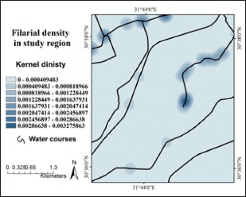
Fig. 6: Modeling of filariasis density in study region.
Zoological Record Indexing
Important Information
- Helpline for Authors
- India: +91-9711224068
- Toll Free: 1800-1234070
- Working hours 10:00 AM-06:00 PM
Issue Bar
Open Access
Side Bar
Identifier
Related Links

International Journal of Mosquito Research